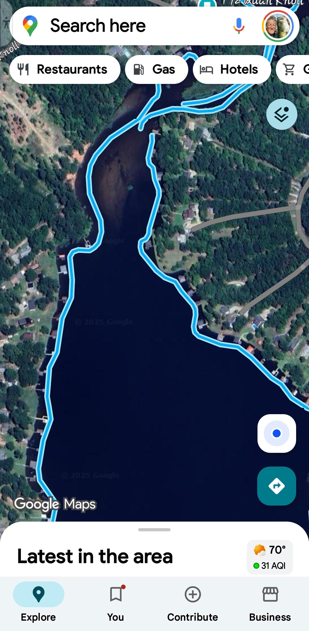
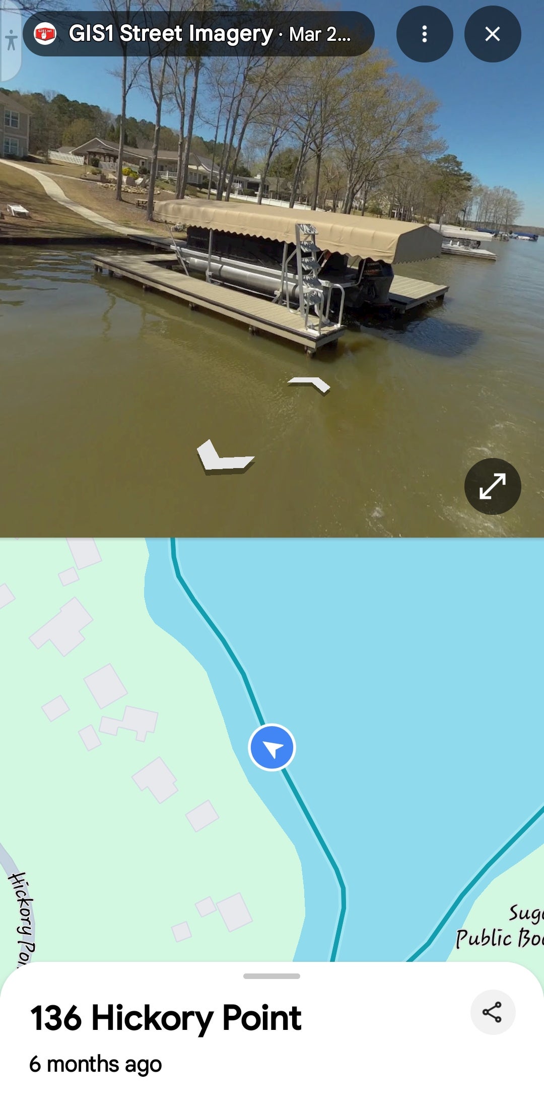
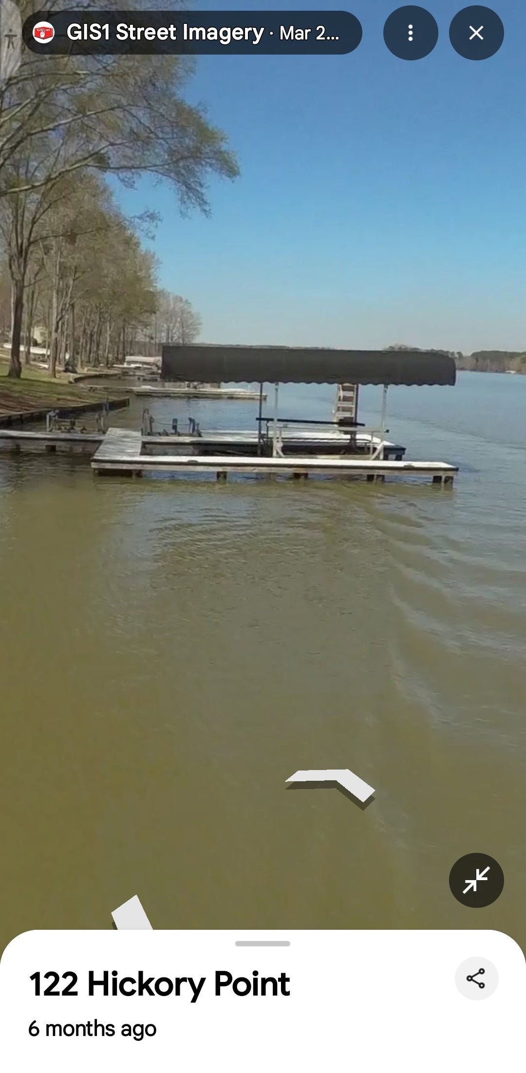

I discovered something we all can use as a tool when we are doing research on a lake that we're about to fish a tournament on.... Google maps now has "street view" from the water... you can go to Google maps, search a lake you're gonna fish, click on the layers at top right, choose "street view" and you'll see the blue line is in the water.. click anywhere on the blue line to look at that dock, that bank, that cove,etc.. They drove a camera boat around the whole lake... it's pretty awesome for research..
